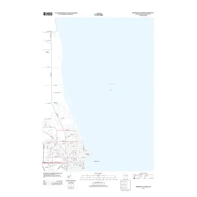
2013 Map of Sheboygan North
USGS Topo · Published 2013About this map
Lake Michigan dominates the eastern half of this coastal survey, where the city's northern neighborhoods meet the Wisconsin shoreline. The lower reaches of the Sheboygan River and the winding Pigeon River define the local drainage, creating a varied landscape of urban street grids and riparian corridors. In the south, the city's public spaces are well-represented by Vollrath Park, including the distinctive Vollrath Bowl, and the riverside Kiwanis Park. Moving north along Lakeshore Rd, the dense residential blocks of the city give way to the smaller settlements of Mosel and Hayen. This transition reveals the shift from Sheboygan's developed core to the more open coastal lands. Mariners and local historians will note the offshore Sheboygan Reef and Sheboygan Point, hazards and landmarks that have long defined this stretch of the lakefront near the Lakeside Ramp.
Find a feature on this map
75 named features on this map. Tap any name to fly to it.
Don’t see what you’re looking for? This feature index may not catch every label — zoom into the map to look around manually.
Map Details
Editions of this 2013 Sheboygan North Map
This is the sole edition of this map. No revisions or reprints were ever made.
Other maps of this area

1954 · Sheboygan Falls
USGS Topo · 1:62,500

1954 · Sheboygan South
USGS Topo · 1:62,500

1954 · Sheboygan Falls
USGS Topo · 1:24,000

1954 · Cleveland
USGS Topo · 1:24,000

1954 · St. Wendel
USGS Topo · 1:24,000

1954 · Sheboygan North
USGS Topo · 1:62,500

1954 · Sheboygan North
USGS Topo · 1:24,000

1954 · Sheboygan South
USGS Topo · 1:24,000

1954 · Howards Grove
USGS Topo · 1:62,500

1954 · Howards Grove
USGS Topo · 1:24,000