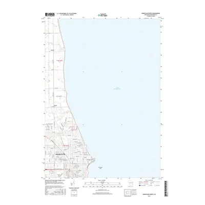
2016 Map of Sheboygan North
USGS Topo · Published 2016About this map
The city of Sheboygan anchors the southern portion of this Wisconsin coastline, where the urban grid meets the western edge of Lake Michigan. This 2016 survey traces the developed shoreline up toward Sheboygan Point, while just offshore, the navigational hazard of Sheboygan Reef sits beneath the lake surface. The northern reaches of the quadrangle transition into the more rural landscapes of Mosel and Haven, defined by agricultural parcels and small creek drainages such as Sevenmile Cr and Meeme Cr. For those researching local heritage, the map provides precise locations for Wildwood Cem and Calvary Cem, situated near the winding course of the Pigeon River. The layout of the road network, including the diagonal path of Calumet Dr, illustrates the intersection of early regional thoroughfares with modern residential expansion along the lakefront.
Find a feature on this map
92 named features on this map. Tap any name to fly to it.
Don’t see what you’re looking for? This feature index may not catch every label — zoom into the map to look around manually.
Map Details
Editions of this 2016 Sheboygan North Map
This is the sole edition of this map. No revisions or reprints were ever made.
Other maps of this area

1954 · Sheboygan Falls
USGS Topo · 1:62,500

1954 · Sheboygan South
USGS Topo · 1:62,500

1954 · Sheboygan Falls
USGS Topo · 1:24,000

1954 · Cleveland
USGS Topo · 1:24,000

1954 · St. Wendel
USGS Topo · 1:24,000

1954 · Sheboygan North
USGS Topo · 1:62,500

1954 · Sheboygan North
USGS Topo · 1:24,000

1954 · Sheboygan South
USGS Topo · 1:24,000

1954 · Howards Grove
USGS Topo · 1:62,500

1954 · Howards Grove
USGS Topo · 1:24,000