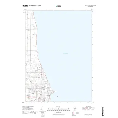
2018 Map of Sheboygan North
USGS Topo · Published 2018About this map
Sheboygan sits along the western shoreline of Lake Michigan, where the river network defines the local geography. The city’s northern residential expansion is bounded by the Pigeon River, while the southern reaches are marked by the presence of Wildwood Cem and Calvary Cem. This 2018 survey reveals the modern suburban layout of the Lake Michigan coast, transitioning from the dense urban grid of Sheboygan into the smaller communities of Mosel and Haven to the north.
Find a feature on this map
91 named features on this map. Tap any name to fly to it.
Don’t see what you’re looking for? This feature index may not catch every label — zoom into the map to look around manually.
Map Details
Editions of this 2018 Sheboygan North Map
This is the sole edition of this map. No revisions or reprints were ever made.
Other maps of this area

1954 · Sheboygan Falls
USGS Topo · 1:62,500

1954 · Sheboygan South
USGS Topo · 1:62,500

1954 · Sheboygan Falls
USGS Topo · 1:24,000

1954 · Cleveland
USGS Topo · 1:24,000

1954 · St. Wendel
USGS Topo · 1:24,000

1954 · Sheboygan North
USGS Topo · 1:62,500

1954 · Sheboygan North
USGS Topo · 1:24,000

1954 · Sheboygan South
USGS Topo · 1:24,000

1954 · Howards Grove
USGS Topo · 1:62,500

1954 · Howards Grove
USGS Topo · 1:24,000