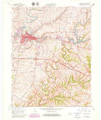
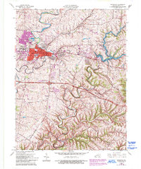
1965 Map of Shelbyville
USGS Topo · Published 1979About this map
Shelbyville serves as the focal point of this mid-century survey, showing the city's development alongside vital transportation and water infrastructure. The map documents the expansion of neighborhoods like Middletown Heights and Snow Hill, while highlighting essential civic sites such as the Municipal Building and the Filtration Plant. A significant landscape feature is the winding course of Guist Creek Lake, which includes the Guist Creek Lake State Park along its eastern shores.
Find a feature on this map
42 named features on this map. Tap any name to fly to it.
Don’t see what you’re looking for? This feature index may not catch every label — zoom into the map to look around manually.
Map Details
Editions of this 1965 Shelbyville Map
5 editions found
Other maps of this area

1923 · Waddy
USGS Topo · 1:48,000

1925 · Mount Eden
USGS Topo · 1:48,000

1927 · Mount Eden
USGS Topo · 1:62,500

1928 · New Castle
USGS Topo · 1:48,000

1929 · Taylorsville
USGS Topo · 1:62,500

1932 · New Castle
USGS Topo · 1:62,500

1932 · La Grange
USGS Topo · 1:62,500

1954 · Ballardsville
USGS Topo · 1:24,000
1954 · Glensboro
USGS Topo · 1:24,000

1954 · Taylorsville
USGS Topo · 1:24,000