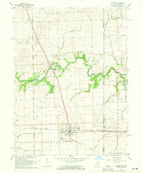
1964 Map of Sheldon
USGS Topo · Published 1965About this map
Sheldon and Iroquois anchor this mid-1960s survey of eastern Iroquois County, where the Illinois prairie meets the Indiana state line at Effner. The landscape is defined by an extensive drainage network, including the meandering Iroquois River and numerous engineered waterways like Concord Ditch and Bonham Ditch. This era shows a robust rail infrastructure crossing the region, with the New York Central and Toledo Peoria and Western intersecting at the Sheldon town site, while the Chicago Milwaukee St Paul and Pacific runs north toward Beaver Creek.
Find a feature on this map
45 named features on this map. Tap any name to fly to it.
Don’t see what you’re looking for? This feature index may not catch every label — zoom into the map to look around manually.
Map Details
Editions of this 1964 Sheldon Map
Other maps of this area

1935 · Watseka
USGS Topo · 1:48,000

1938 · Milford
USGS Topo · 1:48,000

1939 · Watseka
USGS Topo · 1:62,500

1944 · Milford
USGS Topo · 1:62,500

1953 · Danville
USGS Topo · 1:250,000

1955 · Danville
USGS Topo · 1:250,000

1956 · Danville
USGS Topo · 1:250,000

1961 · Kentland
USGS Topo · 1:24,000

1961 · Morocco
USGS Topo · 1:24,000

1962 · Earl Park
USGS Topo · 1:24,000