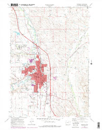
1968 Map of Sheridan
USGS Topo · Published 1978About this map
The city of Sheridan is the focal point of this late-1960s survey, showing its development at the confluence of Goose Creek and Little Goose Creek. As a major regional hub, the map documents significant civic and federal infrastructure, including the sprawling Veterans Adm Hospital and the Sheridan Courthouse. Historic preservation is noted by the Sheridan Inn Nat Hist Landmark near the Burlington Northern railroad tracks, a remnant of the town's frontier railroad heritage.
Find a feature on this map
58 named features on this map. Tap any name to fly to it.
Don’t see what you’re looking for? This feature index may not catch every label — zoom into the map to look around manually.
Map Details
Editions of this 1968 Sheridan Map
3 editions found
Other maps of this area

1895 · Dayton
USGS Topo · 1:125,000

1901 · Dayton
USGS Topo · 1:125,000

1909 · Sheridan
USGS Topo · 1:125,000

1911 · Sheridan
USGS Topo · 1:125,000

1955 · Sheridan
USGS Topo · 1:250,000

1958 · Sheridan
USGS Topo · 1:250,000

1962 · Sheridan
USGS Topo · 1:250,000
1964 · Monarch
USGS Topo · 1:24,000
1964 · Hultz Draw
USGS Topo · 1:24,000
1964 · Beaver Creek Hills
USGS Topo · 1:24,000