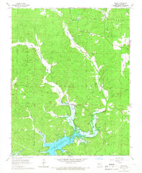
1966 Map of Shook
USGS Topo · Published 1967About this map
Lake Wappapello dominates the southern landscape of this mid-1960s survey, its irregular shoreline reaching into the valleys of Lost Creek and Little Creek. The settlement of Shook serves as a local hub near the confluence of the West Fork and East Fork, where Shiloh Church and Shiloh Cemetery mark the community center. To the north and west, the terrain rises into the protected timberlands of the Clark National Forest, characterized by numerous named hollows like Harper Hollow and Nagle Hollow. Genealogists will find several family-named landmarks and burial sites across the hills, including Thornton Cemetery, Helm Cemetery, and Jones Cemetery. The map also captures the upper reaches of the St. Francis River basin near McGee and the recreational access point at Lost Creek Landing, reflecting an era of transition between traditional upland farming and water-based recreation.
Find a feature on this map
31 named features on this map. Tap any name to fly to it.
Don’t see what you’re looking for? This feature index may not catch every label — zoom into the map to look around manually.
Map Details
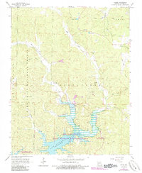
Editions of this 1966 Shook Map
2 editions found
Other maps of this area

1934 · Greenville
USGS Topo · 1:62,500

1934 · Puxico
USGS Topo · 1:62,500

1935 · Poplar Bluff
USGS Topo · 1:62,500

1935 · Zalma
USGS Topo · 1:62,500

1939 · Greenville
USGS Topo · 1:62,500

1939 · Puxico
USGS Topo · 1:62,500

1939 · Zalma
USGS Topo · 1:62,500

1939 · Poplar Bluff
USGS Topo · 1:62,500

1949 · Rolla
USGS Topo · 1:250,000

1949 · Poplar Bluff
USGS Topo · 1:62,500