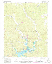
1966 Map of Shook
USGS Topo · Published 1985About this map
Lake Wappapello dominates the southern landscape of this mid-1960s survey, illustrating a region defined by its managed water and protected woodlands. The small community of Shook sits near the northern reaches of the lake's West Fork, where researchers can find the Shiloh Ch and adjacent Shiloh Cem. The terrain rises into the timbered ridges of the Mark Twain National Forest, while the northern section remains more rural and scattered, with the settlement of McGee positioned near Blue Hole Branch.
Find a feature on this map
34 named features on this map. Tap any name to fly to it.
Don’t see what you’re looking for? This feature index may not catch every label — zoom into the map to look around manually.
Map Details
Editions of this 1966 Shook Map
2 editions found
Other maps of this area

1934 · Greenville
USGS Topo · 1:62,500

1934 · Puxico
USGS Topo · 1:62,500

1935 · Poplar Bluff
USGS Topo · 1:62,500

1935 · Zalma
USGS Topo · 1:62,500

1939 · Greenville
USGS Topo · 1:62,500

1939 · Puxico
USGS Topo · 1:62,500

1939 · Zalma
USGS Topo · 1:62,500

1939 · Poplar Bluff
USGS Topo · 1:62,500

1949 · Rolla
USGS Topo · 1:250,000

1949 · Poplar Bluff
USGS Topo · 1:62,500