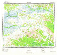
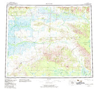
1955 Map of Shungnak
USGS Topo · Published 1965About this map
The Arctic Circle bisects this remote landscape, where the Kobuk River serves as the primary artery for travel and trade. Small riverside settlements like Shungnak and Kobuk represent the established hubs of the region during the mid-1950s, while the designation of Kalla (Site) suggests a location of earlier habitation. The terrain is defined by the convergence of the Sheklukshuk Range and the Waring Mountains, with the Pah River Flats providing a distinct break in the elevation to the southeast.
Find a feature on this map
52 named features on this map. Tap any name to fly to it.
Don’t see what you’re looking for? This feature index may not catch every label — zoom into the map to look around manually.
Map Details
Editions of this 1955 Shungnak Map
6 editions found

Other maps of this area

1951 · Candle
USGS Topo · 1:250,000

1951 · Baird Mountains
USGS Topo · 1:250,000

1951 · Selawik
USGS Topo · 1:250,000

1951 · Shungnak
USGS Topo · 1:250,000

1951 · Kateel River
USGS Topo · 1:250,000

1951 · Hughes
USGS Topo · 1:250,000

1951 · Melozitna
USGS Topo · 1:250,000

1951 · Survey Pass
USGS Topo · 1:250,000

1951 · Ambler River
USGS Topo · 1:250,000

1954 · Kateel River D-1
USGS Topo · 1:63,360