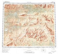
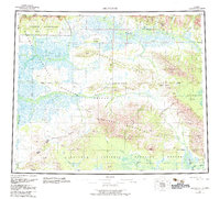
1955 Map of Shungnak
USGS Topo · Published 1975About this map
The Kobuk River valley serves as the primary corridor for human activity in this remote Arctic landscape, anchoring the settlements of Shungnak and Kobuk. In the mid-1950s, these villages existed alongside the historic Kalla (Site) near the Kolloksak River confluence. The region is defined by its topographic diversity, from the broad Pah River Flats in the southeast to the sharp elevations of the Sheklukshuk Range and Kilionilik Range.
Find a feature on this map
104 named features on this map. Tap any name to fly to it.
Don’t see what you’re looking for? This feature index may not catch every label — zoom into the map to look around manually.
Map Details
Editions of this 1955 Shungnak Map
6 editions found

Other maps of this area

1951 · Candle
USGS Topo · 1:250,000

1951 · Baird Mountains
USGS Topo · 1:250,000

1951 · Selawik
USGS Topo · 1:250,000

1951 · Shungnak
USGS Topo · 1:250,000

1951 · Kateel River
USGS Topo · 1:250,000

1951 · Hughes
USGS Topo · 1:250,000

1951 · Melozitna
USGS Topo · 1:250,000

1951 · Survey Pass
USGS Topo · 1:250,000

1951 · Ambler River
USGS Topo · 1:250,000

1954 · Kateel River D-1
USGS Topo · 1:63,360