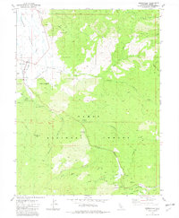
1981 Map of Sierraville
USGS Topo · Published 1982About this map
Sierraville and the settlement of Randolph sit at the southern edge of the Sierra Valley, serving as gateway points into the timber-heavy landscape of the Tahoe National Forest. By the early 1980s, the area’s economic reliance on the land is evident through the network of logging roads and resource-related infrastructure, including a Radio Facility and several gravel and borrow pits. The terrain is deeply incised by drainages such as Lemon Canyon and Turner Canyon, while the historic Henness Pass and an Old RR Grade mark the traditional transportation corridors through these mountains.
Find a feature on this map
38 named features on this map. Tap any name to fly to it.
Don’t see what you’re looking for? This feature index may not catch every label — zoom into the map to look around manually.
Map Details
Editions of this 1981 Sierraville Map
2 editions found
Other maps of this area

1890 · Sierraville
USGS Topo · 1:125,000

1891 · Truckee
USGS Topo · 1:125,000

1892 · Sierraville
USGS Topo · 1:125,000

1893 · Truckee
USGS Topo · 1:125,000

1894 · Sierraville
USGS Topo · 1:125,000

1895 · Truckee
USGS Topo · 1:125,000

1932 · Truckee
USGS Topo · 1:96,000

1940 · Truckee
USGS Topo · 1:125,000

1955 · Loyalton
USGS Topo · 1:62,500
1955 · Donner Pass
USGS Topo · 1:62,500