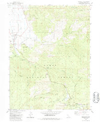
1981 Map of Sierraville
USGS Topo · Published 1986About this map
The Sierra Valley opens into a landscape of high timber and narrow canyons in this early 1980s topographical study. The settlement of Sierraville and the adjacent community of Randolph anchor the northwestern edge of the map, situated where Sierraville Creek and Perry Creek emerge from the steep slopes of Randolph Hill. This area is characterized by its transition from the agricultural valley floor to the protected lands of the Tahoe National Forest, where the terrain rises sharply toward landmarks like Treasure Mtn and Harding Point.
Find a feature on this map
33 named features on this map. Tap any name to fly to it.
Don’t see what you’re looking for? This feature index may not catch every label — zoom into the map to look around manually.
Map Details
Editions of this 1981 Sierraville Map
2 editions found
Other maps of this area

1890 · Sierraville
USGS Topo · 1:125,000

1891 · Truckee
USGS Topo · 1:125,000

1892 · Sierraville
USGS Topo · 1:125,000

1893 · Truckee
USGS Topo · 1:125,000

1894 · Sierraville
USGS Topo · 1:125,000

1895 · Truckee
USGS Topo · 1:125,000

1932 · Truckee
USGS Topo · 1:96,000

1940 · Truckee
USGS Topo · 1:125,000

1955 · Loyalton
USGS Topo · 1:62,500
1955 · Donner Pass
USGS Topo · 1:62,500