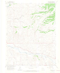
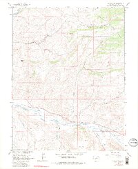
1964 Map of Signal Peak
USGS Topo · Published 1967About this map
Signal Peak rises above a landscape defined by deep drainages and early western transportation corridors in the Colorado high country. The southern portion of the map is dominated by the valley of Tomichi Creek, where an Old Railroad Grade follows the water's path toward its confluence with the Gunnison River. This corridor shows the marks of development and resource extraction with numerous prospects and a Gravel Pit scattered across the slopes. To the north, the terrain transitions into the Gunnison National Forest, cut by the winding Lost Canyon Road. The network of gulches, including Sheep Gulch and Chance Gulch, reveals a complex topography of high ridges and isolated water sources like Biebel Springs and various unnamed springs that supported the area's grazing and mining interests during the mid-twentieth century.
Find a feature on this map
26 named features on this map. Tap any name to fly to it.
Don’t see what you’re looking for? This feature index may not catch every label — zoom into the map to look around manually.
Map Details
Editions of this 1964 Signal Peak Map
5 editions found
Other maps of this area

1941 · Pitkin
USGS Topo · 1:62,500

1945 · Pitkin
USGS Topo · 1:62,500

1954 · Iris NW
USGS Topo · 1:24,000

1954 · Gunnison
USGS Topo · 1:24,000

1956 · Montrose
USGS Topo · 1:250,000

1959 · Montrose
USGS Topo · 1:250,000

1960 · Montrose
USGS Topo · 1:250,000

1962 · Iris
USGS Topo · 1:24,000

1962 · Houston Gulch
USGS Topo · 1:24,000
1964 · Flat Top
USGS Topo · 1:24,000