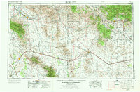
1954 Map of Silver City
USGS Topo · Published 1973About this map
Silver City and the surrounding high desert of the Arizona-New Mexico borderlands center this regional study, which highlights a landscape shaped by mining and cattle ranching. Large-scale industrial footprints are visible at the Tyrone Mine, Santa Rita Mine, and the Chino Pit, illustrating the mineral wealth that drove development in Grant County. Further west, the vast Willcox Playa and the Sulphur Springs Valley define the arid lowlands, while the Gila National Forest and Coronado National Forest protect the mountainous horizons.
Find a feature on this map
68 named features on this map. Tap any name to fly to it.
Don’t see what you’re looking for? This feature index may not catch every label — zoom into the map to look around manually.
Map Details
Editions of this 1954 Silver City Map
4 editions found

Other maps of this area

1899 · Deming
USGS Topo · 1:125,000

1902 · Clifton
USGS Topo · 1:62,500

1909 · Silver City
USGS Topo · 1:125,000

1910 · Mogollon
USGS Topo · 1:125,000

1911 · Alum Mountain
USGS Topo · 1:125,000

1912 · Mogollon
USGS Topo · 1:125,000

1913 · Alum Mountain
USGS Topo · 1:125,000

1913 · Morenci
USGS Topo · 1:125,000

1915 · Benson
USGS Topo · 1:125,000

1915 · Morenci
USGS Topo · 1:125,000