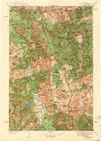
1942 Map of Silvertip
USGS Topo · Published 1942About this map
The Continental Divide serves as the central spine of this wilderness survey, separating the headwaters of the South Fork Flathead River from the tributaries of the North Fork Sun River. The landscape is defined by the high peaks of the Lewis and Clark Range and the Swan Range, where early 20th-century mountain management is visible through a network of remote outposts. Remote outposts like the Big Prairie Ranger Station and Salmon Forks Guard Station indicate the administrative presence of the era, supported by isolated airstrips such as the Big Prairie Landing Field and Meadow Creek Landing Field.
Find a feature on this map
77 named features on this map. Tap any name to fly to it.
Don’t see what you’re looking for? This feature index may not catch every label — zoom into the map to look around manually.
Map Details
Editions of this 1942 Silvertip Map
2 editions found

Other maps of this area

1902 · Ovando
USGS Topo · 1:125,000

1903 · Saypo
USGS Topo · 1:125,000

1903 · Coopers Lake
USGS Topo · 1:125,000

1905 · Ovando
USGS Topo · 1:125,000

1913 · Marias Pass
USGS Topo · 1:125,000

1914 · Nyack
USGS Topo · 1:125,000

1914 · Heart Butte
USGS Topo · 1:125,000

1918 · Heart Butte
USGS Topo · 1:125,000

1921 · Elbow Lake
USGS Topo · 1:125,000

1936 · Silvertip
USGS Topo · 1:96,000