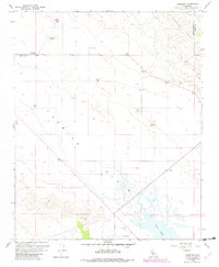
1959 Map of Simmler
USGS Topo · Published 1982About this map
The Carrizo Plain and the eastern edge of the Temblor Range dominate this 1959 survey, updated with 1982 revisions. The settlement at Simmler serves as a focal point, supported by the Community Hall and the nearby Goodwin Ranch Airport. This arid landscape is shaped by the extraction of local resources, evidenced by multiple Strip Mine operations and industrial Grain sites.
Find a feature on this map
16 named features on this map. Tap any name to fly to it.
Don’t see what you’re looking for? This feature index may not catch every label — zoom into the map to look around manually.
Map Details
Editions of this 1959 Simmler Map
3 editions found
Other maps of this area

1912 · McKittrick
USGS Topo · 1:125,000

1932 · La Panza
USGS Topo · 1:48,000

1935 · La Panza
USGS Topo · 1:62,500

1936 · La Panza
USGS Topo · 1:62,500

1937 · Branch Mtn
USGS Topo · 1:48,000

1941 · Caliente Mountain
USGS Topo · 1:62,500

1942 · Branch Mountain
USGS Topo · 1:62,500

1942 · Caliente Mtn
USGS Topo · 1:62,500

1943 · Simmler
USGS Topo · 1:62,500

1943 · Caliente Mtn.
USGS Topo · 1:62,500