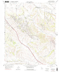
1959 Map of Sisquoc
USGS Topo · Published 1978About this map
The Santa Maria River corridor defines the northern edge of this landscape, where the settlement of Sisquoc sits at the junction of the Santa Maria Valley and Tepusquet Creek. This mid-century survey reveals a territory heavily shaped by the petroleum industry, with extensive infrastructure supporting the Orcutt Oil Field, Cat Canyon Oil Field, and Gato Ridge Oil Field across the Solomon Hills. The network of private roads and pipelines suggests the intense mid-century extraction activity in these canyons.
Find a feature on this map
38 named features on this map. Tap any name to fly to it.
Don’t see what you’re looking for? This feature index may not catch every label — zoom into the map to look around manually.
Map Details
Editions of this 1959 Sisquoc Map
3 editions found
Other maps of this area

1905 · Lompoc
USGS Topo · 1:125,000

1942 · Lompoc
USGS Topo · 1:125,000

1942 · Lompoc
USGS Topo · 1:62,500

1942 · Santa Maria
USGS Topo · 1:62,500

1942 · Tepusquet Peak
USGS Topo · 1:62,500

1942 · Los Olivos
USGS Topo · 1:62,500

1943 · Los Olivos
USGS Topo · 1:62,500

1943 · Tepusquet Peak
USGS Topo · 1:62,500

1943 · Lompoc
USGS Topo · 1:125,000

1947 · Lompoc
USGS Topo · 1:24,000