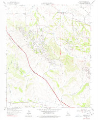
1959 Map of Sisquoc
USGS Topo · Published 1978About this map
The Santa Maria Valley and the northern Solomon Hills define this central California landscape at the close of the 1950s. The small settlement of Sisquoc sits along the Santa Maria River, serving as a focal point for the surrounding agricultural and ranching lands. Nearby, the Blochman Union Sch and Sisquoc Grange underscore the rural community's social structure during this period.
Find a feature on this map
31 named features on this map. Tap any name to fly to it.
Don’t see what you’re looking for? This feature index may not catch every label — zoom into the map to look around manually.
Map Details
Editions of this 1959 Sisquoc Map
3 editions found
Other maps of this area

1905 · Lompoc
USGS Topo · 1:125,000

1942 · Lompoc
USGS Topo · 1:125,000

1942 · Lompoc
USGS Topo · 1:62,500

1942 · Santa Maria
USGS Topo · 1:62,500

1942 · Tepusquet Peak
USGS Topo · 1:62,500

1942 · Los Olivos
USGS Topo · 1:62,500

1943 · Los Olivos
USGS Topo · 1:62,500

1943 · Tepusquet Peak
USGS Topo · 1:62,500

1943 · Lompoc
USGS Topo · 1:125,000

1947 · Lompoc
USGS Topo · 1:24,000