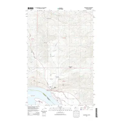
2014 Map of Skamokawa
USGS Topo · Published 2014About this map
Skamokawa sits at the heart of this coastal Washington landscape, where the Columbia River meets a network of sloughs and valleys. This 2014 survey illustrates the complex geography of the river's north bank, detailing the Skamokawa Channel, Brooks Slough, and Steamboat Slough which wrap around Price Island and Welch Island. The settlement pattern follows the drainages northward into Middle Valley, West Valley, and East Valley, showing how the local population is distributed along the creek beds and lowlands between the rising coastal hills.
Find a feature on this map
60 named features on this map. Tap any name to fly to it.
Don’t see what you’re looking for? This feature index may not catch every label — zoom into the map to look around manually.
Map Details
Editions of this 2014 Skamokawa Map
This is the sole edition of this map. No revisions or reprints were ever made.
Other maps of this area

1940 · Svensen
USGS Topo · 1:62,500

1940 · Brookfield
USGS Topo · 1:62,500

1941 · Skamokawa
USGS Topo · 1:62,500

1941 · Cathlamet
USGS Topo · 1:62,500

1953 · Hoquiam
USGS Topo · 1:250,000

1953 · Skamokawa
USGS Topo · 1:62,500

1953 · Cathlamet
USGS Topo · 1:62,500
1955 · Svensen
USGS Topo · 1:62,500

1955 · Grays River
USGS Topo · 1:62,500

1957 · Hoquiam
USGS Topo · 1:250,000