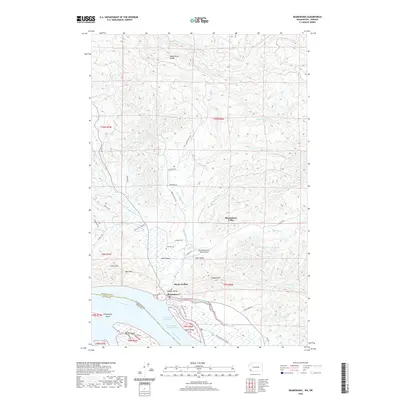
2020 Map of Skamokawa
USGS Topo · Published 2020About this map
Skamokawa sits at the northern edge of the Columbia River, marking a complex geography where river sloughs meet the rising timberlands of Wahkiakum County. The settlement pattern follows the narrow drainages of Skamokawa Creek into the interior, branching into localized communities like Skamokawa Valley, Middle Valley, and East Valley. These low-lying areas contrast sharply with the surrounding heights of Lutes Mountain and Moe Hill. Along the riverbank, the map details the shifting maritime environment of the Skamokawa Channel, defined by large alluvial landforms such as Welch Island and Price Island. Transportation is dictated by the terrain, with family-named routes like Peterson Road and Quigley Road providing access to upland areas, while the Skamokawa East Valley Airport serves as a modern link to this river-bound landscape. For those researching local roots, the Fern Hill Cemetery remains a significant landmark near the historic valley floor.
Find a feature on this map
60 named features on this map. Tap any name to fly to it.
Don’t see what you’re looking for? This feature index may not catch every label — zoom into the map to look around manually.
Map Details
Editions of this 2020 Skamokawa Map
This is the sole edition of this map. No revisions or reprints were ever made.
Other maps of this area

1940 · Svensen
USGS Topo · 1:62,500

1940 · Brookfield
USGS Topo · 1:62,500

1941 · Skamokawa
USGS Topo · 1:62,500

1941 · Cathlamet
USGS Topo · 1:62,500

1953 · Hoquiam
USGS Topo · 1:250,000

1953 · Skamokawa
USGS Topo · 1:62,500

1953 · Cathlamet
USGS Topo · 1:62,500
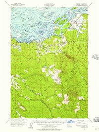
1955 · Svensen
USGS Topo · 1:62,500

1955 · Grays River
USGS Topo · 1:62,500

1957 · Hoquiam
USGS Topo · 1:250,000