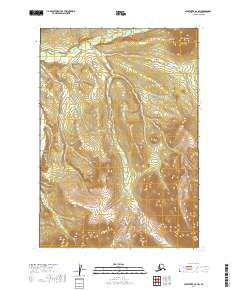
2019 Map of Sleetmute B-6 SW
USGS Topo · Published 2019About this map
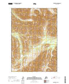
Chineekluk Mtn dominates the northeastern corner of this remote Alaskan landscape, marking the transition between the high ridges and the winding drainage systems that define the Bethel Census Area. The area is characterized by an intricate network of waterways, most notably Chineekluk Creek and Kiokluk Cr, which weave through the terrain. This U.S. Geological Survey topographic study illustrates the vast wilderness of the Sleetmute region, where the Public Land Survey System grid lines of townships like t14n r50w and t15n r49w intersect with a natural landscape of steep contours and glacial-carved valleys. The relationship between the high peak and the creek basins below suggests a classic subarctic watershed, captured with modern precision while remaining largely devoid of permanent human structures or roads.
Find a feature on this map
10 named features on this map. Tap any name to fly to it.
Don’t see what you’re looking for? This feature index may not catch every label — zoom into the map to look around manually.
Map Details
Editions of this 2019 Sleetmute B-6 SW Map
This is the sole edition of this map. No revisions or reprints were ever made.
Other maps of this area

1950 · Sleetmute
USGS Topo · 1:250,000

1954 · Sleetmute
USGS Topo · 1:250,000

1954 · Sleetmute A-7
USGS Topo · 1:63,360

1954 · Sleetmute A-6
USGS Topo · 1:63,360

1954 · Sleetmute B-6
USGS Topo · 1:63,360

1954 · Sleetmute B-7
USGS Topo · 1:63,360
2019 · Sleetmute B-7 NE
USGS Topo · 1:25,000
2019 · Sleetmute A-7 NE
USGS Topo · 1:25,000
2019 · Sleetmute B-6 NW
USGS Topo · 1:25,000
2019 · Sleetmute A-6 NW
USGS Topo · 1:25,000