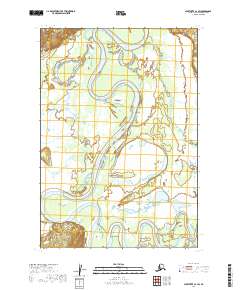
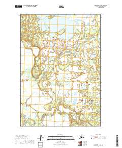
2019 Map of Sleetmute C-3 SW
USGS Topo · Published 2019About this map
The Holitna River dominates this interior landscape as it winds through a dense network of wetlands and oxbow lakes in the Bethel Census Area. The map records a complex riverine environment where the main channel is mirrored by secondary waterways like Barge Slough and Johnny Slough, illustrating the dynamic nature of Alaska's southwestern waterways. Rising above the low-lying marshland, Beaverhouse Hill provides a distinct topographic landmark in an otherwise saturated terrain. Smaller tributaries such as Basket Cr feed into the system, which is partitioned by the Public Land Survey System into townships like t17n r43w and t18n r43w. This 2019 survey documents the intricate drainage patterns and relief of a remote region defined by its water-carved geography.
Find a feature on this map
11 named features on this map. Tap any name to fly to it.
Don’t see what you’re looking for? This feature index may not catch every label — zoom into the map to look around manually.
Map Details
Editions of this 2019 Sleetmute C-3 SW Map
This is the sole edition of this map. No revisions or reprints were ever made.
Other maps of this area

1950 · Sleetmute
USGS Topo · 1:250,000

1954 · Sleetmute C-4
USGS Topo · 1:63,360

1954 · Sleetmute C-3
USGS Topo · 1:63,360

1954 · Sleetmute
USGS Topo · 1:250,000

1954 · Sleetmute B-3
USGS Topo · 1:63,360

1954 · Sleetmute B-4
USGS Topo · 1:63,360
2019 · Sleetmute B-3 NE
USGS Topo · 1:25,000
2019 · Sleetmute C-3 NW
USGS Topo · 1:25,000
2019 · Sleetmute C-3 NE
USGS Topo · 1:25,000
2019 · Sleetmute C-3 SE
USGS Topo · 1:25,000