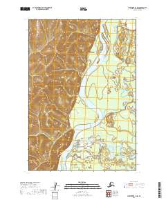
2019 Map of Sleetmute D-1 NW
USGS Topo · Published 2019About this map
The Kuskokwim River serves as the dominant geographical artery in this region of the Bethel Census Area, carving a wide valley between the high, ridged terrain to the west and the marshy lowlands to the east. The river’s winding course is supplemented by significant tributaries, including the Tatlawiksuk River and the Swift River, which drain into the main channel through a complex network of wetlands and seasonal floodplains. This 2019 survey illustrates the intricate riparian environment where these water systems converge, highlighting the lack of modern infrastructure and the persistence of a wilderness landscape. The relief on the western bank contrasts sharply with the eastern flats, showing how the natural hydrology of the Kuskokwim basin dictates the shape of the land.
Find a feature on this map
7 named features on this map. Tap any name to fly to it.
Don’t see what you’re looking for? This feature index may not catch every label — zoom into the map to look around manually.
Map Details
Editions of this 2019 Sleetmute D-1 NW Map
This is the sole edition of this map. No revisions or reprints were ever made.
Other maps of this area

1950 · Sleetmute
USGS Topo · 1:250,000

1951 · Iditarod
USGS Topo · 1:250,000

1954 · Sleetmute D-1
USGS Topo · 1:63,360

1954 · Sleetmute D-2
USGS Topo · 1:63,360

1954 · Iditarod A-1
USGS Topo · 1:63,360

1954 · Sleetmute
USGS Topo · 1:250,000

1956 · Iditarod
USGS Topo · 1:250,000
2019 · Sleetmute D-1 SW
USGS Topo · 1:25,000
2019 · Sleetmute D-2 NE
USGS Topo · 1:25,000
2019 · Sleetmute D-1 SE
USGS Topo · 1:25,000