
1950 Map of Slide Peak
USGS Topo · Published 1956About this map
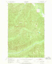
The Olympic National Forest and the Olympic National Park define the character of this mountainous landscape in the early 1950s. The terrain is marked by distinctive high points such as Sore Thumb, Misery Peak, and Slide Peak. These peaks serve as the headwaters for several significant waterways, including the Soleduck River and the Bogachiel River, which carve deep valleys through the heavily contoured topography. Backcountry infrastructure of the era is represented by specific waypoints like the Twentyone mile Shelter and Hyak Shelter, situated along established trails. This survey preserves the exact boundaries of the Olympic Primitive Area before modern management shifts, showing a region where access was limited to footpaths and the natural drainage patterns of creeks like Hyak Creek and Alckee Creek dictated travel.
Find a feature on this map
28 named features on this map. Tap any name to fly to it.
Don’t see what you’re looking for? This feature index may not catch every label — zoom into the map to look around manually.
Map Details
Editions of this 1950 Slide Peak Map
4 editions found
Other maps of this area

1918 · Lake Crescent
USGS Topo · 1:62,500

1922 · Pysht
USGS Topo · 1:62,500

1922 · Lake Crescent
USGS Topo · 1:62,500

1939 · Mount Tom
USGS Topo · 1:62,500

1942 · Pysht
USGS Topo · 1:62,500

1943 · Spruce Mountain
USGS Topo · 1:62,500

1943 · Copalis Beach
USGS Topo · 1:250,000

1950 · Mount Muller
USGS Topo · 1:24,000

1950 · Lake Crescent
USGS Topo · 1:24,000
1950 · Bogachiel Peak
USGS Topo · 1:24,000