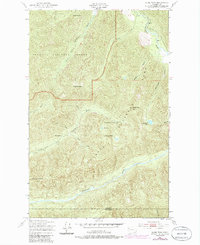
1950 Map of Slide Peak
USGS Topo · Published 1986About this map
Soleduck River and the Bogachiel River define this high-altitude landscape along the border of Clallam and Jefferson counties. Originally mapped in the 1940s and 1950s, the terrain represents a transition between the Olympic National Forest and Olympic National Park. The topography is dominated by steep ridges and peaks such as Slide Peak, Misery Peak, and the distinctively named Sore Thumb. The map reveals the early foot-travel infrastructure of the backcountry, highlighting remote outposts like Hyak Shelter and Twentyone mile Shelter. These locations, along with the Low Divide, mark significant points for researchers tracing old trail routes and early wilderness management. Hidden within the high basins are isolated water bodies like Ring Lake and Blackwood Lake, which feed the complex network of tributaries including Hyak Creek and Alckee Creek.
Find a feature on this map
23 named features on this map. Tap any name to fly to it.
Don’t see what you’re looking for? This feature index may not catch every label — zoom into the map to look around manually.
Map Details
Editions of this 1950 Slide Peak Map
4 editions found
Other maps of this area

1918 · Lake Crescent
USGS Topo · 1:62,500

1922 · Pysht
USGS Topo · 1:62,500

1922 · Lake Crescent
USGS Topo · 1:62,500

1939 · Mount Tom
USGS Topo · 1:62,500

1942 · Pysht
USGS Topo · 1:62,500

1943 · Spruce Mountain
USGS Topo · 1:62,500

1943 · Copalis Beach
USGS Topo · 1:250,000

1950 · Mount Muller
USGS Topo · 1:24,000

1950 · Lake Crescent
USGS Topo · 1:24,000

1950 · Slide Peak
USGS Topo · 1:24,000