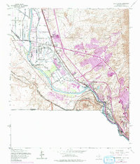
1955 Map of Smeltertown
USGS Topo · Published 1975About this map
Smeltertown and the northern outskirts of El Paso anchor this mid-century look at the international border zone where the Rio Grande separates Texas and New Mexico from Chihuahua, Mexico. The landscape is defined by the sharp transition from the irrigated valley floors of the Montoya Main Lateral to the rising slopes of the Franklin Mountains and Coronado Hills. This map documents a critical period of regional development, capturing the Sunland Park Racetrack and the Sunland Airport alongside long-established communities like Montoya and Courchesne.
Find a feature on this map
44 named features on this map. Tap any name to fly to it.
Don’t see what you’re looking for? This feature index may not catch every label — zoom into the map to look around manually.
Map Details
Editions of this 1955 Smeltertown Map
5 editions found

Other maps of this area

1896 · El Paso
USGS Topo · 1:125,000

1908 · El Paso
USGS Topo · 1:125,000

1917 · Canutillo
USGS Topo · 1:62,500

1919 · Canutillo
USGS Topo · 1:62,500

1939 · Ysleta
USGS Topo · 1:62,500

1941 · El Paso
USGS Topo · 1:31,680

1941 · Ysleta
USGS Topo · 1:62,500

1942 · Fort Bliss
USGS Topo · 1:62,500

1943 · El Paso
USGS Topo · 1:31,680

1945 · Ysleta
USGS Topo · 1:62,500