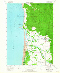
1956 Map of Smith River
USGS Topo · Published 1964About this map
The Smith River Indian Reservation and the historical Yontocket (Indian Village Site) stand as central cultural landmarks along the northern California coast in this mid-1950s survey. The landscape is defined by the powerful convergence of the Smith River and the Pacific Ocean, creating a complex network of coastal wetlands including Tillas Slough and Yontocket Slough. To the north, the terrain rises into the timber-heavy slopes of the Siskiyou National Forest, while the coastal strip shows signs of 20th-century development at Smith River and Winton Corners. A prominent Lumber Mill and several gravel pits indicate the era's reliance on natural resource extraction. The map also records early coastal infrastructure such as the Quarantine Station near the Oregon border and local recreational sites like Pelican Beach State Park.
Find a feature on this map
43 named features on this map. Tap any name to fly to it.
Don’t see what you’re looking for? This feature index may not catch every label — zoom into the map to look around manually.
Map Details
Editions of this 1956 Smith River Map
2 editions found
Other maps of this area

1929 · Crescent City
USGS Topo · 1:125,000

1945 · Point St. George
USGS Topo · 1:62,500

1949 · Eureka
USGS Topo · 1:250,000

1952 · Crescent City
USGS Topo · 1:62,500

1954 · Coos Bay
USGS Topo · 1:250,000

1954 · Cape Ferrelo
USGS Topo · 1:62,500

1954 · Mt. Emily
USGS Topo · 1:62,500

1956 · Crescent City
USGS Topo · 1:24,000

1956 · Smith River
USGS Topo · 1:24,000

1958 · Eureka
USGS Topo · 1:250,000