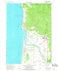
1966 Map of Smith River
USGS Topo · Published 1968About this map
The coastal borderlands of Del Norte County and Curry County meet where the Winchuck River flows into the Pacific Ocean. This landscape is defined by the massive estuary system of the Smith River, where tidal influences reach deep into the coastal plain via Tillas Slough and Delilah Slough. The topography transitions sharply from the shoreline's Sand Dunes and the prominent Prince Island to the rising timberlands of the Siskiyou National Forest.
Find a feature on this map
60 named features on this map. Tap any name to fly to it.
Don’t see what you’re looking for? This feature index may not catch every label — zoom into the map to look around manually.
Map Details
Editions of this 1966 Smith River Map
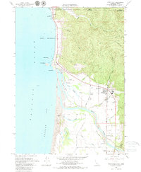
2 editions found
Other maps of this area

1929 · Crescent City
USGS Topo · 1:125,000

1945 · Point St. George
USGS Topo · 1:62,500

1949 · Eureka
USGS Topo · 1:250,000

1952 · Crescent City
USGS Topo · 1:62,500

1954 · Coos Bay
USGS Topo · 1:250,000

1954 · Cape Ferrelo
USGS Topo · 1:62,500

1954 · Mt. Emily
USGS Topo · 1:62,500

1956 · Crescent City
USGS Topo · 1:24,000

1956 · Smith River
USGS Topo · 1:24,000

1958 · Eureka
USGS Topo · 1:250,000