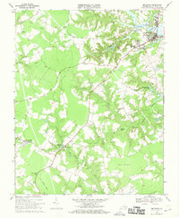
1968 Map of Smithfield
USGS Topo · Published 1970About this map
The Pagan River shoreline anchors this 1960s study of the Smithfield area, showing a landscape defined by tidewater inlets and expansive swamp systems. While the town center shows development around Ivy Hill Cem and the Westside High Sch, the surrounding Isle of Wight County terrain remains largely agricultural and wooded. A network of wetlands including Holly Mount Swamp, Champion Swamp, and the Ross Pocosin dictates the placement of crossroads like Foursquare and Magnet.
Find a feature on this map
33 named features on this map. Tap any name to fly to it.
Don’t see what you’re looking for? This feature index may not catch every label — zoom into the map to look around manually.
Map Details
Editions of this 1968 Smithfield Map
4 editions found
Other maps of this area

1907 · Yorktown
USGS Topo · 1:62,500

1919 · Smithfield
USGS Topo · 1:62,500

1919 · Surry
USGS Topo · 1:62,500

1920 · Ivor
USGS Topo · 1:62,500

1943 · Yorktown
USGS Topo · 1:62,500

1943 · Richmond
USGS Topo · 1:250,000

1944 · Windsor
USGS Topo · 1:31,680

1944 · Smithfield
USGS Topo · 1:24,000

1944 · Raynor
USGS Topo · 1:24,000

1944 · Zuni
USGS Topo · 1:24,000