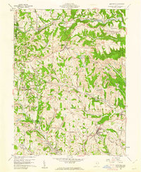
1960 Map of Smithfield
USGS Topo · Published 1961About this map
The heavy concentration of Strip Mine operations across the landscape of Jefferson County in 1960 reveals an era of intense surface mining. While the village of Smithfield serves as a local hub with its Fairgrounds and Stadium, the surrounding terrain is a complex network of ridgeline roads and deep drainage basins like Opossum Hollow and Gunyon Hollow. The presence of Gas Wells and an Oil Well near Unionport further highlights the region's reliance on mineral extraction.
Find a feature on this map
76 named features on this map. Tap any name to fly to it.
Don’t see what you’re looking for? This feature index may not catch every label — zoom into the map to look around manually.
Map Details
Editions of this 1960 Smithfield Map
4 editions found
Other maps of this area

1901 · Cadiz
USGS Topo · 1:62,500

1902 · Wheeling
USGS Topo · 1:62,500

1903 · Cadiz
USGS Topo · 1:62,500

1904 · Steubenville
USGS Topo · 1:62,500

1905 · St. Clairsville
USGS Topo · 1:62,500

1935 · Wheeling
USGS Topo · 1:62,500

1935 · Steubenville
USGS Topo · 1:62,500

1942 · Wheeling
USGS Topo · 1:62,500

1942 · Steubenville
USGS Topo · 1:62,500

1951 · Canton
USGS Topo · 1:250,000