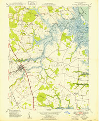
1949 Map of Smyrna
USGS Topo · Published 1949About this map
Smyrna serves as the hub of this coastal Delaware landscape, where the Smyrna River meanders eastward toward the Delaware Bay. The 1940s town layout is clearly visible, anchored by Lake Como and the State Welfare Home, with historic estates like Belmont Hall and Bannister Hall marking the outskirts. The geography is defined by a transition from inland agricultural districts to the vast tidal wetlands of Broadway Meadows and the Bombay Hook National Wildlife Refuge.
Find a feature on this map
48 named features on this map. Tap any name to fly to it.
Don’t see what you’re looking for? This feature index may not catch every label — zoom into the map to look around manually.
Map Details
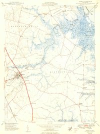
Editions of this 1949 Smyrna Map
2 editions found
Other maps of this area

1890 · Bay Side
USGS Topo · 1:62,500

1894 · Bay Side
USGS Topo · 1:62,500

1899 · Vineland
USGS Topo · 1:125,000

1899 · Dover
USGS Topo · 1:125,000

1906 · Dover
USGS Topo · 1:125,000

1919 · Vineland
USGS Topo · 1:125,000

1920 · Dover
USGS Topo · 1:125,000

1926 · Wyoming
USGS Topo · 1:48,000

1930 · Wyoming
USGS Topo · 1:62,500

1931 · Wyoming
USGS Topo · 1:62,500
Featured Places
- Smyrna, DE
- Colmar Manor, DE
- Village of Garrison Lake, DE
- Woodland Court Mobile Home Park, DE
- Hedgerow Hollow Mobile Home Park, DE