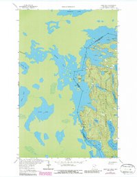
1963 Map of Snow Bay
USGS Topo · Published 1987About this map
The international border between the United States and Canada bisects this water-dominated landscape within the Superior National Forest. This 1963 survey, photorevised in the mid-1980s, delineates the intricate shoreline of the Boundary Waters Canoe Area, where the massive expanse of Trout Lake and Wilkins Bay meets the Canadian waters of Thompson Lake. Historically significant transport routes are documented through labels like Dawson Portage and Beatty Portage, which connect these sprawling glacial lakes. The map provides a high-resolution look at the complex island and bay systems of the Rainy River District, including Sandbar Island and Snow Bay. Numerous campsite locations are marked, reflecting the area's established role as a remote wilderness destination during the latter half of the twentieth century. Small interior water bodies such as Auchagah Lake, Norway Lake, and Beatty Lake are meticulously mapped within the protected forest boundaries.
Find a feature on this map
25 named features on this map. Tap any name to fly to it.
Don’t see what you’re looking for? This feature index may not catch every label — zoom into the map to look around manually.
Map Details
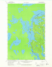
Editions of this 1963 Snow Bay Map
3 editions found
Other maps of this area

1954 · International Falls
USGS Topo · 1:250,000

1957 · International Falls
USGS Topo · 1:250,000

1958 · International Falls
USGS Topo · 1:250,000

1963 · Echo Lake
USGS Topo · 1:24,000

1963 · Takucmich Lake
USGS Topo · 1:24,000

1963 · Snow Bay
USGS Topo · 1:24,000

1963 · Redhorse Bay
USGS Topo · 1:24,000

1963 · Lake Jeanette
USGS Topo · 1:24,000

1963 · Crane Lake
USGS Topo · 1:24,000
1963 · Shell Lake
USGS Topo · 1:24,000