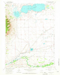
1963 Map of Sodergreen Lake
USGS Topo · Published 1965About this map
The Laramie River winds through the southern reaches of this landscape, its waters diverted into an intricate network of irrigation channels including the Sodergreen High Line Ditch and the Pioneer Canal. This 1960s survey reveals a high-plains ranching economy defined by water rights and family holdings, with named sites such as the Sodergreen Ranch, Johnson Ranch, and Hanson Ranch dotting the terrain. The northern half is dominated by the expansive Lake Hattie Reservoir and the smaller Sodergreen Lake. To the west, the topography rises sharply into the Medicine Bow National Forest, where Sheep Mountain stands within the Sheep Mountain Federal Game Refuge. Local community life is anchored at the Harmony Sch, while the presence of the Lake Hattie Supply Canal and various ditches like Fisher Ditch illustrate the engineering required to sustain agriculture in this arid Wyoming environment.
Find a feature on this map
44 named features on this map. Tap any name to fly to it.
Don’t see what you’re looking for? This feature index may not catch every label — zoom into the map to look around manually.
Map Details
Editions of this 1963 Sodergreen Lake Map
2 editions found
Other maps of this area

1895 · Laramie
USGS Topo · 1:125,000

1902 · Laramie
USGS Topo · 1:125,000

1905 · Laramie
USGS Topo · 1:125,000

1906 · Medicine Bow
USGS Topo · 1:125,000

1906 · Laramie
USGS Topo · 1:125,000

1908 · Laramie
USGS Topo · 1:125,000

1908 · Medicine Bow
USGS Topo · 1:125,000

1954 · Cheyenne
USGS Topo · 1:250,000

1954 · Rawlins
USGS Topo · 1:250,000

1958 · Rawlins
USGS Topo · 1:250,000