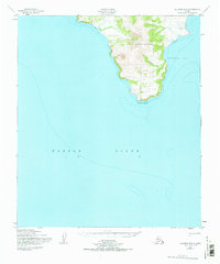
1950 Map of Solomon B-3
USGS Topo · Published 1970About this map
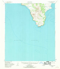
Iknutak Mountain dominates this coastal landscape along the Seward Peninsula, rising sharply above the eastern reaches of Norton Sound. This topographic study reveals a sparsely inhabited coastline where survival relied on the proximity to water and protected harbors like Golovnin Bay. The presence of isolated Cabin and Cabins sites along the shoreline, coupled with a navigational Light at the coastal edge, suggests a landscape defined by seasonal subsistence and maritime transit rather than permanent inland settlement. Significant Tidal Flat areas and the drainage of Bunshfoot Creek illustrate the complex transition between the upland tundra and the sea. Data for this sheet was compiled in part from late 19th-century hydrographic surveys, preserving the coastal profiles known to early mariners and indigenous inhabitants before mid-century photogrammetric updates.
Find a feature on this map
9 named features on this map. Tap any name to fly to it.
Don’t see what you’re looking for? This feature index may not catch every label — zoom into the map to look around manually.
Map Details
Editions of this 1950 Solomon B-3 Map
3 editions found
Other maps of this area

1950 · Solomon B-3
USGS Topo · 1:63,360

1950 · Solomon B-2
USGS Topo · 1:63,360

1950 · Solomon C-4
USGS Topo · 1:63,360

1950 · Solomon C-2
USGS Topo · 1:63,360

1950 · Solomon
USGS Topo · 1:250,000

1950 · Solomon C-3
USGS Topo · 1:63,360

1951 · Solomon
USGS Topo · 1:250,000

2014 · Solomon C-3 SE
USGS Topo · 1:25,000

2014 · Solomon B-2 NW
USGS Topo · 1:25,000
2014 · Solomon B-3 NE
USGS Topo · 1:25,000