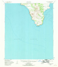
1950 Map of Solomon B-3
USGS Topo · Published 1970About this map
Iknutak Mountain dominates this coastal landscape on the Seward Peninsula, rising sharply above the waters where Golovnin Bay meets the expansive Norton Sound. The topography, derived from mid-century aerial photography, reveals a rugged shoreline terminating at Rocky Point. A small collection of Cabins and a lone Cabin are situated along the eastern coastline, indicating seasonal or subsistence use of the area near the mouth of Bansheloot Creek. This document incorporates hydrographic data from much earlier Usc&GS surveys from 1899 and 1900, preserving a record of the shoreline and depth curves before the mid-twentieth century. Navigation is aided by a Light positioned on the eastern edge, guarding the entrance to the bay where a large Tidal Flat stretches toward the northern reaches of the quadrangle.
Find a feature on this map
10 named features on this map. Tap any name to fly to it.
Don’t see what you’re looking for? This feature index may not catch every label — zoom into the map to look around manually.
Map Details
Editions of this 1950 Solomon B-3 Map
3 editions found
Other maps of this area

1950 · Solomon B-3
USGS Topo · 1:63,360

1950 · Solomon B-2
USGS Topo · 1:63,360

1950 · Solomon C-4
USGS Topo · 1:63,360

1950 · Solomon C-2
USGS Topo · 1:63,360

1950 · Solomon
USGS Topo · 1:250,000

1950 · Solomon C-3
USGS Topo · 1:63,360

1951 · Solomon
USGS Topo · 1:250,000

2014 · Solomon C-3 SE
USGS Topo · 1:25,000

2014 · Solomon B-2 NW
USGS Topo · 1:25,000
2014 · Solomon B-3 NE
USGS Topo · 1:25,000