
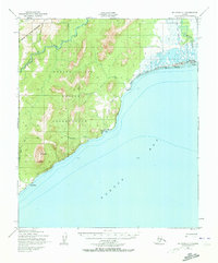
1950 Map of Solomon C-1
USGS Topo · Published 1956About this map
The Norton Bay Native Reservation dominates this 1950 coastal landscape, where the rugged Darby Mountains meet the waters of Norton Bay. This terrain is defined by a subsistence and transit economy, evidenced by the Moses Point Fishing Village and the remote outpost of Elim. The interior is marked by seasonal movement, with several instances of Winter Trail (Approx Align) crossing the tundra and following the drainage of the Kwiniuk River.
Find a feature on this map
19 named features on this map. Tap any name to fly to it.
Don’t see what you’re looking for? This feature index may not catch every label — zoom into the map to look around manually.
Map Details
Editions of this 1950 Solomon C-1 Map
4 editions found
Other maps of this area

1948 · Norton Bay
USGS Topo · 1:250,000

1950 · Norton Bay D-6
USGS Topo · 1:63,360

1950 · Solomon B-2
USGS Topo · 1:63,360

1950 · Solomon D-2
USGS Topo · 1:63,360

1950 · Solomon C-2
USGS Topo · 1:63,360

1950 · Norton Bay C-6
USGS Topo · 1:63,360

1950 · Solomon D-1
USGS Topo · 1:63,360

1950 · Solomon
USGS Topo · 1:250,000

1951 · Solomon
USGS Topo · 1:250,000

1951 · Norton Bay
USGS Topo · 1:250,000