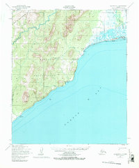
1950 Map of Solomon C-1
USGS Topo · Published 1980About this map
Norton Bay Native Reservation dominates this coastal landscape, showing the intersection of traditional land use and mid-century transportation infrastructure. The map documents the Moses Point Fishing Village and the village of Elim along the shore, where subsistence living met modern needs as evidenced by the nearby Moses Point Landing Strip and Radio Beacons. Further south, the settlement of Walla Walla sits at the foot of the Darby Mountains, near the dramatic Marble Cliffs of Mt Kwiniuk.
Find a feature on this map
20 named features on this map. Tap any name to fly to it.
Don’t see what you’re looking for? This feature index may not catch every label — zoom into the map to look around manually.
Map Details
Editions of this 1950 Solomon C-1 Map
4 editions found
Other maps of this area

1948 · Norton Bay
USGS Topo · 1:250,000

1950 · Norton Bay D-6
USGS Topo · 1:63,360

1950 · Solomon B-2
USGS Topo · 1:63,360

1950 · Solomon D-2
USGS Topo · 1:63,360

1950 · Solomon C-2
USGS Topo · 1:63,360

1950 · Solomon C-1
USGS Topo · 1:63,360

1950 · Norton Bay C-6
USGS Topo · 1:63,360

1950 · Solomon D-1
USGS Topo · 1:63,360

1950 · Solomon
USGS Topo · 1:250,000

1951 · Solomon
USGS Topo · 1:250,000