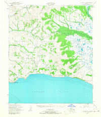
1950 Map of Solomon C-4
USGS Topo · Published 1967About this map
Bluff and Topkok anchor this coastal stretch of the Seward Peninsula along the northern reaches of Norton Sound, as it appeared in the mid-20th century. The landscape is defined by a complex network of waterways, including the Fish River and Skookum River, which flow toward the sea from a terrain marked by numerous creek basins. Evidence of human infrastructure is visible in the various Ditch alignments and the presence of a Landing Strip near Basin Creek, suggesting the logistical demands of mining or transport in this subarctic environment.
Find a feature on this map
43 named features on this map. Tap any name to fly to it.
Don’t see what you’re looking for? This feature index may not catch every label — zoom into the map to look around manually.
Map Details
Editions of this 1950 Solomon C-4 Map
3 editions found
Other maps of this area

1907 · Casadepaga
USGS Topo · 1:62,500

1907 · Solomon
USGS Topo · 1:62,500

1950 · Solomon B-3
USGS Topo · 1:63,360

1950 · Solomon C-5
USGS Topo · 1:63,360

1950 · Solomon C-4
USGS Topo · 1:63,360

1950 · Solomon D-3
USGS Topo · 1:63,360

1950 · Solomon
USGS Topo · 1:250,000

1950 · Solomon C-3
USGS Topo · 1:63,360

1950 · Solomon D-4
USGS Topo · 1:63,360

1950 · Solomon D-5
USGS Topo · 1:63,360