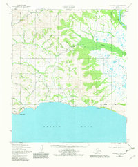
1950 Map of Solomon C-4
USGS Topo · Published 1982About this map
Bluff and the neighboring settlement of Tonok anchor the coastal edge of this landscape along Norton Sound, representing the small hubs of activity in this remote region. The map reveals an extensive network of watercourses and early transportation routes, including the Fox Bar Landing Strip and sections of the Winter Trail. These paths, alongside the Gay Road, illustrate the seasonal and rugged nature of travel through the Seward Peninsula during the mid-20th century.
Find a feature on this map
47 named features on this map. Tap any name to fly to it.
Don’t see what you’re looking for? This feature index may not catch every label — zoom into the map to look around manually.
Map Details
Editions of this 1950 Solomon C-4 Map
3 editions found
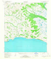
Other maps of this area

1907 · Casadepaga
USGS Topo · 1:62,500

1907 · Solomon
USGS Topo · 1:62,500

1950 · Solomon B-3
USGS Topo · 1:63,360

1950 · Solomon C-5
USGS Topo · 1:63,360

1950 · Solomon C-4
USGS Topo · 1:63,360

1950 · Solomon D-3
USGS Topo · 1:63,360

1950 · Solomon
USGS Topo · 1:250,000

1950 · Solomon C-3
USGS Topo · 1:63,360

1950 · Solomon D-4
USGS Topo · 1:63,360

1950 · Solomon D-5
USGS Topo · 1:63,360