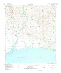
1950 Map of Solomon C-5
USGS Topo · Published 1973About this map
The Solomon River corridor reveals a landscape defined by the legacies of the Seward Peninsula's mining era. This mid-century survey captures the industrial remains of the coastal settlements at Solomon and Dickson, where the Solomon Railroad Grade and Old Railroad Grade trace the transport routes that once served the gold fields. Further inland, the presence of Big Hurrah Mine and various camps like Quigleys Camp and Lees Camp indicate the spread of prospecting activity up the river's tributaries. Aviation's role in this remote territory is evident through the Solomon Landing Strip, Ruby Creek Airstrip, and other unnamed landing strips. The map also documents the rugged interior geography, dominated by Uncle Sam Mountain and the steep coastal bluff at Topkok Head, alongside seasonal routes such as the Winter Trail used to navigate the terrain when the ground was frozen.
Find a feature on this map
96 named features on this map. Tap any name to fly to it.
Don’t see what you’re looking for? This feature index may not catch every label — zoom into the map to look around manually.
Map Details
Editions of this 1950 Solomon C-5 Map
3 editions found
Other maps of this area

1907 · Casadepaga
USGS Topo · 1:62,500

1907 · Solomon
USGS Topo · 1:62,500

1950 · Solomon C-5
USGS Topo · 1:63,360

1950 · Solomon C-6
USGS Topo · 1:63,360

1950 · Solomon C-4
USGS Topo · 1:63,360

1950 · Solomon B-6
USGS Topo · 1:63,360

1950 · Solomon
USGS Topo · 1:250,000

1950 · Solomon D-6
USGS Topo · 1:63,360

1950 · Solomon D-4
USGS Topo · 1:63,360

1950 · Solomon D-5
USGS Topo · 1:63,360