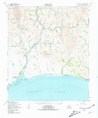
1950 Map of Solomon C-5
USGS Topo · Published 1981About this map
Solomon and Dickson anchor this coastal survey where the Solomon Railroad Grade follows the river inland through a landscape of mining camps and prospecting history. The terrain is dominated by Uncle Sam Mountain and the Big Hurrah Mine, which sits along the creek of the same name. Traces of previous infrastructure are visible throughout, including the Old Railroad Grade and the Winter Trail cutting across the tundra. Remote settlements like Quigleys Camp and Lees Camp emphasize the area's isolation and its reliance on the river valleys for movement. Along the Norton Sound coast, the Solomon Landing Strip and a light near the tidal flats mark essential navigation points for a region shaped by the boom and bust of Alaskan resource extraction.
Find a feature on this map
104 named features on this map. Tap any name to fly to it.
Don’t see what you’re looking for? This feature index may not catch every label — zoom into the map to look around manually.
Map Details
Editions of this 1950 Solomon C-5 Map
3 editions found
Other maps of this area

1907 · Casadepaga
USGS Topo · 1:62,500

1907 · Solomon
USGS Topo · 1:62,500

1950 · Solomon C-5
USGS Topo · 1:63,360

1950 · Solomon C-6
USGS Topo · 1:63,360

1950 · Solomon C-4
USGS Topo · 1:63,360

1950 · Solomon B-6
USGS Topo · 1:63,360

1950 · Solomon
USGS Topo · 1:250,000

1950 · Solomon D-6
USGS Topo · 1:63,360

1950 · Solomon D-4
USGS Topo · 1:63,360

1950 · Solomon D-5
USGS Topo · 1:63,360