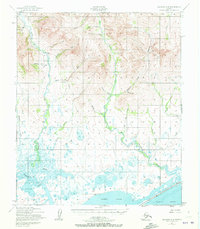
1950 Map of Solomon C-6
USGS Topo · Published 1972About this map
The Eldorado River dominates this landscape, winding through a complex network of waterways and marshlands just north of the Alaskan coast. Surveyed in 1950, this region shows a transition from the upland creeks such as Moonlight Creek and Quartz Creek to the expansive tidewaters of Safety Sound and Norton Sound. The presence of Gold Run and Eureka Creek suggests the area's history of mineral exploration, while a Landing Strip near Pajara Creek highlights the necessity of air travel in this remote part of the Nome region. The drainage patterns of the Bonanza River and Flambeau River illustrate the watery geography that shaped early transportation and access to the interior. Researchers will find a preserved look at the natural hydrology of the Seward Peninsula, including smaller tributaries like Harrison Cr and Volunteer Creek.
Find a feature on this map
26 named features on this map. Tap any name to fly to it.
Don’t see what you’re looking for? This feature index may not catch every label — zoom into the map to look around manually.
Map Details
Editions of this 1950 Solomon C-6 Map
3 editions found
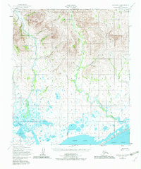
Other maps of this area

1907 · Casadepaga
USGS Topo · 1:62,500

1907 · Solomon
USGS Topo · 1:62,500

1950 · Nome
USGS Topo · 1:250,000

1950 · Solomon C-5
USGS Topo · 1:63,360

1950 · Solomon C-6
USGS Topo · 1:63,360

1950 · Nome B-1
USGS Topo · 1:63,360

1950 · Solomon B-6
USGS Topo · 1:63,360

1950 · Solomon
USGS Topo · 1:250,000

1950 · Solomon D-6
USGS Topo · 1:63,360

1950 · Nome D-1
USGS Topo · 1:63,360