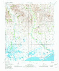
1950 Map of Solomon C-6
USGS Topo · Published 1982About this map
The Safety Sound coast and its network of braided river deltas define this 1950 topographical study of the Seward Peninsula near Nome. The landscape is dominated by the massive south-flowing drainage of the Eldorado River and the Flambeau River, which converge toward the lagoons of Norton Sound. These waterways carve through a terrain marked by the gold-bearing history of the region, evidenced by names like Gold Run, Gold Creek, and Bonanza River.
Find a feature on this map
35 named features on this map. Tap any name to fly to it.
Don’t see what you’re looking for? This feature index may not catch every label — zoom into the map to look around manually.
Map Details
Editions of this 1950 Solomon C-6 Map
3 editions found
Other maps of this area

1907 · Casadepaga
USGS Topo · 1:62,500

1907 · Solomon
USGS Topo · 1:62,500

1950 · Nome
USGS Topo · 1:250,000

1950 · Solomon C-5
USGS Topo · 1:63,360

1950 · Solomon C-6
USGS Topo · 1:63,360

1950 · Nome B-1
USGS Topo · 1:63,360

1950 · Solomon B-6
USGS Topo · 1:63,360

1950 · Solomon
USGS Topo · 1:250,000

1950 · Solomon D-6
USGS Topo · 1:63,360

1950 · Nome D-1
USGS Topo · 1:63,360