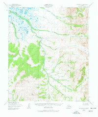
1950 Map of Solomon D-2
USGS Topo · Published 1977About this map
The Darby Mountains dominate the eastern landscape of this mid-century survey, rising sharply from a complex network of glacial valleys and subarctic drainage basins. The Rathlatulik River serpentines through the central lowlands, joined by tributaries such as Omilak Creek and Dry Canyon Creek. This remote terrain shows very little human footprint, evidenced only by a single Cabin near the northern marshlands, suggesting a landscape primarily used for seasonal hunting or prospecting. To the south and west, the topography is defined by the high elevations of Mt Rathlatuluk and Mt Kachauik, where the Kachauik River begins its descent. The map reveals the intricate braided nature of the Etchepuk River and its surrounding wetlands, illustrating the raw, unshaped character of the Seward Peninsula's interior before modern development.
Find a feature on this map
11 named features on this map. Tap any name to fly to it.
Don’t see what you’re looking for? This feature index may not catch every label — zoom into the map to look around manually.
Map Details
Editions of this 1950 Solomon D-2 Map
3 editions found
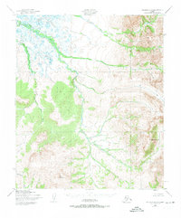
Other maps of this area

1950 · Bendeleben A-3
USGS Topo · 1:63,360

1950 · Bendeleben A-2
USGS Topo · 1:63,360

1950 · Bendeleben A-1
USGS Topo · 1:63,360

1950 · Solomon D-2
USGS Topo · 1:63,360

1950 · Solomon C-2
USGS Topo · 1:63,360

1950 · Bendeleben
USGS Topo · 1:250,000

1950 · Solomon C-1
USGS Topo · 1:63,360

1950 · Solomon D-1
USGS Topo · 1:63,360

1950 · Solomon D-3
USGS Topo · 1:63,360

1950 · Solomon
USGS Topo · 1:250,000