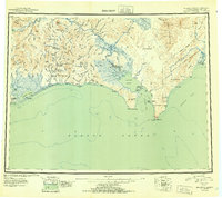
1951 Map of Solomon
USGS Topo · Published 1951About this map
The Seward Peninsula Railroad traces a path through this coastal landscape during the mid-twentieth century, connecting the hinterlands of the Second Judicial Division to the waters of Norton Sound. This reconnaissance study illustrates the mining and transportation infrastructure established in the wake of the Gold Rush, highlighting the Big Hurrah Mine and remote settlements like Council and Casadepaga. The geography is defined by the transition from the Kigluaik Mountains in the west to the Darby Mountains in the east, with a complex system of lagoons and spits such as Safety Sound and Golovnin Lagoon along the southern coastline.
Find a feature on this map
43 named features on this map. Tap any name to fly to it.
Don’t see what you’re looking for? This feature index may not catch every label — zoom into the map to look around manually.
Map Details
Editions of this 1951 Solomon Map
3 editions found

Other maps of this area

1907 · Casadepaga
USGS Topo · 1:62,500

1907 · Solomon
USGS Topo · 1:62,500

1948 · Norton Bay
USGS Topo · 1:250,000

1950 · Bendeleben A-6
USGS Topo · 1:63,360

1950 · Bendeleben A-4
USGS Topo · 1:63,360

1950 · Bendeleben A-5
USGS Topo · 1:63,360

1950 · Bendeleben A-3
USGS Topo · 1:63,360

1950 · Bendeleben A-2
USGS Topo · 1:63,360

1950 · Bendeleben A-1
USGS Topo · 1:63,360

1950 · Solomon B-3
USGS Topo · 1:63,360