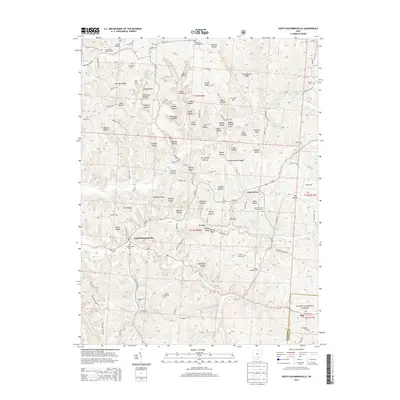
2013 Map of South Bloomingville
USGS Topo · Published 2013About this map
South Bloomingville sits at the junction of Queer Creek and Goose Creek, serving as a central hub for this corner of Hocking County. The landscape is defined by its dramatic hollows and ridges, from Gold Mine Hollow in the north to Red Rock Hollow near the center. Public lands, including parts of the Wayne National Forest, overlay much of the area, punctuated by legacy sites like the Rock House Lookout Tower and Ash Cave Lookout Tower. These fire lookouts and the numerous cemeteries—such as Old Baptist Cem and Wesley Chapel Cem—illustrate a rural geography where early pioneer settlements were often organized around ridge-top churches and small stream valleys. Significant water features like the Hocking Hills Reservoir and Blackjack Lake provide contrast to the deeply dissected terrain of the Chapel Ridge area.
Find a feature on this map
157 named features on this map. Tap any name to fly to it.
Don’t see what you’re looking for? This feature index may not catch every label — zoom into the map to look around manually.
Map Details
Editions of this 2013 South Bloomingville Map
This is the sole edition of this map. No revisions or reprints were ever made.
Other maps of this area

1904 · Zaleski
USGS Topo · 1:62,500

1907 · Zaleski
USGS Topo · 1:62,500

1907 · Logan
USGS Topo · 1:62,500

1907 · Lancaster
USGS Topo · 1:62,500

1909 · Lancaster
USGS Topo · 1:62,500

1909 · Logan
USGS Topo · 1:62,500

1910 · Laurelville
USGS Topo · 1:62,500

1912 · Laurelville
USGS Topo · 1:62,500

1944 · Laurelville
USGS Topo · 1:62,500

1947 · Columbus
USGS Topo · 1:250,000