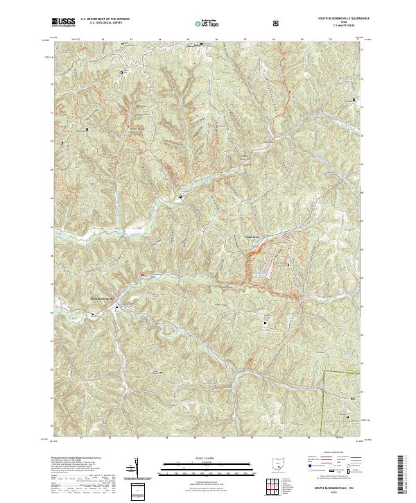
2023 Map of South Bloomingville
USGS Topo · Published 2023About this map
South Bloomingville and Gibsonville anchor this survey of the rugged Hocking County interior, where steep ridges and narrow hollows dictate the layout of rural life. The landscape is defined by its numerous small burial grounds, including the Methodist Episcopal Cem and Saint John the Baptist Cem, which reflect the tight-knit pioneer settlements of these hills. The area is a significant corridor for local transit and recreation, featuring the North Country National Scenic Trl and the Buckeye Trl winding through the Wayne National Forest. Notable landmarks such as the Hagley Hollow Arch and Ash Cave Cabins highlight the distinct geological character of the region. Waterways like Queer Creek and Little Pine Creek cut through deep drainages such as Gold Mine Hollow and Brineinger Hollow, illustrating the difficult terrain that historical residents navigated.
Find a feature on this map
125 named features on this map. Tap any name to fly to it.
Don’t see what you’re looking for? This feature index may not catch every label — zoom into the map to look around manually.
Map Details
Editions of this 2023 South Bloomingville Map
This is the sole edition of this map. No revisions or reprints were ever made.
Other maps of this area

1904 · Zaleski
USGS Topo · 1:62,500

1907 · Zaleski
USGS Topo · 1:62,500

1907 · Logan
USGS Topo · 1:62,500

1907 · Lancaster
USGS Topo · 1:62,500

1909 · Lancaster
USGS Topo · 1:62,500

1909 · Logan
USGS Topo · 1:62,500

1910 · Laurelville
USGS Topo · 1:62,500

1912 · Laurelville
USGS Topo · 1:62,500

1944 · Laurelville
USGS Topo · 1:62,500

1947 · Columbus
USGS Topo · 1:250,000