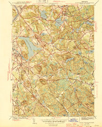
1944 Map of South Groveland
USGS Topo · Published 1944About this map
Lake Cochichewick dominates the central landscape of this 1940s Essex County survey, surrounded by the evolving residential and educational fabric of North Andover and North Andover Center. The map reveals a post-depression era of transition where long-established institutional footprints like the Brooks School and the Lawrence Municipal Airport sit alongside the traditional glacial topography of the region.
Find a feature on this map
79 named features on this map. Tap any name to fly to it.
Don’t see what you’re looking for? This feature index may not catch every label — zoom into the map to look around manually.
Map Details
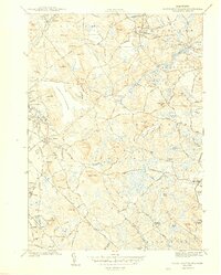
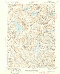
Editions of this 1944 South Groveland Map
3 editions found
Other maps of this area

1886 · Lawrence
USGS Topo · 1:62,500

1888 · Newburyport
USGS Topo · 1:62,500

1888 · Haverhill
USGS Topo · 1:62,500

1888 · Lawrence
USGS Topo · 1:62,500

1888 · Salem
USGS Topo · 1:62,500

1890 · Haverhill
USGS Topo · 1:62,500

1890 · Newburyport
USGS Topo · 1:62,500

1893 · Salem
USGS Topo · 1:62,500

1893 · Lawrence
USGS Topo · 1:62,500

1893 · Haverhill
USGS Topo · 1:62,500