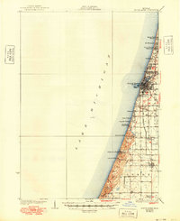
1930 Map of South Haven
USGS Topo · Published 1948About this map
The Lake Michigan shoreline dominates this 1927 survey, showing the established port of South Haven alongside a series of growing summer communities and camps. To the south, the landscape transitions from the developed streets and Waterworks Intake of the city to the dune-heavy terrain of Van Buren State Park and Roosevelt Hills. The presence of Camp Na Wa Kwa and numerous lakefront settlements like Palisades Park and Miami Park Beach reflects the region's early 20th-century character as a premier destination for seasonal residents.
Find a feature on this map
34 named features on this map. Tap any name to fly to it.
Don’t see what you’re looking for? This feature index may not catch every label — zoom into the map to look around manually.
Map Details
Editions of this 1930 South Haven Map
4 editions found
Other maps of this area

1927 · Hartford
USGS Topo · 1:62,500

1927 · Bangor
USGS Topo · 1:62,500

1927 · Benton Harbor
USGS Topo · 1:62,500

1927 · South Haven
USGS Topo · 1:62,500

1928 · Fennville
USGS Topo · 1:62,500

1930 · South Haven
USGS Topo · 1:62,500

1930 · Benton Harbor
USGS Topo · 1:62,500

1931 · Fennville
USGS Topo · 1:62,500

1931 · Bangor
USGS Topo · 1:62,500

1931 · Hartford
USGS Topo · 1:62,500