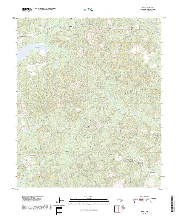
2024 Map of Sparta
USGS Topo · Published 2024About this map
Sparta and Lucky anchor this Bienville Parish landscape, characterized by the winding headwaters of several critical southern Louisiana drainage systems. The terrain is defined by a dense network of parish roads that navigate the ridges between Castor Creek, Sixmile Creek, and Blooms Mill Creek. These waterways, along with Edwards Mill Creek and Watts Branch, indicate a legacy of timber and milling activity essential to the local economy. The concentration of family and community burial sites, including the Blume Family Cem and the Boddie Cem, provides a detailed record of established families and rural congregations. The western portion of the map features Kepler Creek Lake, a significant local reservoir created by the damming of Kepler Creek, which reshaped the geography from its earlier stream-fed valley into the prominent water body seen today.
Find a feature on this map
56 named features on this map. Tap any name to fly to it.
Don’t see what you’re looking for? This feature index may not catch every label — zoom into the map to look around manually.
Map Details
Editions of this 2024 Sparta Map
This is the sole edition of this map. No revisions or reprints were ever made.
Other maps of this area

1947 · Goldonna
USGS Topo · 1:62,500

1947 · Ashland
USGS Topo · 1:62,500

1947 · Bienville
USGS Topo · 1:62,500

1948 · Jamestown
USGS Topo · 1:62,500

1949 · Jamestown
USGS Topo · 1:62,500

1949 · Bienville
USGS Topo · 1:62,500

1955 · Shreveport
USGS Topo · 1:250,000

1956 · Shreveport
USGS Topo · 1:250,000

1957 · Goldonna
USGS Topo · 1:62,500

1957 · Ashland
USGS Topo · 1:62,500